SIRGAS

Loading

SIRGAS

Workshop “Installation and operation of permanent GNSS stations. How to include them in SIRGAS-CON?”

Between August 26 and 31, 2022, the virtual workshopInstallation and operation of permanent GNSS stations will be held. How to include them in SIRGAS-CON?” This workshop is aimed at the geodetic community of SIRGAS and the Caribbean, mainly at current and future GNSS data centers and the main objective is to train participants on the installation and operation of permanent GNSS stations, carrying out a series of practical activities. about the metadata, formats and contribution of SIRGAS to the products and IGS reference framework.

This workshop will be held through the Zoom platform, on August 26, 29, 30 and 31, 2022, at 2:00 p.m. (UTC 0), lasting one hour every day.

The Workshop will also be broadcast simultaneously on the SIRGAS YouTube channel, and will have simultaneous translation ENG-ESP, ESP-ENG

Registration: https://reuna.zoom.us/meeting/register/tZwude6hrTgtHtRznzK5F7g_z8CJkp0gO5YD

Programming:

Day
Exhibitor
Subject
26/08
Annie Zaino

UNAVCO – US

Steps and details on the installation of a permanent GNSS station
29/08
Sonia Costa

IBGE – Brasil

Basic steps about receivers configuration
30/08
José Antonio Tarrío

Universidad Santiago de Chile – Chile

Jesarella Inzunza

Universidad Santiago de Chile – Chile

Evaluation of data and metadata from GNSS stations

Procedure for the inclusion of stations in the SIRGAS-CON Network

31/08
Laura Sanchez

Technische Universität München – TUM/Alemania

Inclusion of SIRGAS-CON stations in the IGS (products and reference network)

SIRGAS 2022 Symposium

The next SIRGAS Symposium will be held in the city of Santiago de Chile, November 7-9, 2022, thanks to the invitation offered by the Instituto Geográfico Militar (IGM) of Chile, in celebration of its 100th anniversary. The geodetic community of the Americas and the Caribbean will gather during this event to formulate new projects and exchange experiences and progress related to the implementation, maintenance and use of the geodetic reference frame and infrastructure of the region.

In addition, the Vertical Reference System Workshop will take place the week before the Symposium, November 2-4 2022, which will cover topics related to the unification of the vertical reference in the SIRGAS member states, as well as the guidelines and actions planned for the materialization of the IHRS (International Height Reference System).

This edition of the SIRGAS Symposium and the Vertical Reference System Workshop is jointly organized with the Military Geographic Institute of Chile, and has the support of the Pan-American Institute of Geography and History (PAIGH) and the International Association of Geodesy (IAG).

Download 1st Circular of the SIRGAS 2022 Symposium

Visit SIRGAS 2022 Symposium website

Workshop Height systems and Gravity

Objective: This Workshop is aimed at the SIRGAS community, and the objective is to create capacity on height systems (IHRS/IHRF), gravity systems (IGRS/IGRF), and to update the practical activities about heights, gravity, and geoid in SIRGAS.

Format: This Workshop will be held through the Zoom platform, between May 2 to 6, 2022, at 2:00 PM (UTC 0), for one hour every day. The Workshop will be in Spanish.

The Workshop will also be broadcast simultaneously on the SIRGAS YouTube channel.

Application form: https://forms.gle/WnKzknFt8G9cqRAZ7

Program:

Day
Exhibitor
Topic
02/05
Laura Sánchez 

Technische Universität München – TUM/Germany

International Height System: Definition (IHRS), Realization (IHRF), Current Status
03/05
Gabriel do N. Guimarães

Universidade Federal de Uberlândia – UFU/Brazil

Status of the IHRF in the SIRGAS region
04/05
Denizar Blitzkow

Centro de Estudos de Geodesia – CENEGEO/Brazil

Universidade de São Paulo – USP/Brasil

Ana Cristina O. C.  de Matos

Centro de Estudos de Geodesia – CENEGEO/Brazil

Gravimetry and Geoid in the SIRGAS region
05/05
Ezequiel D. Antokoletz

Universidad Nacional de La Plata – UNLP/Argentina
Consejo Nacional de Investigaciones Científicas y Técnicas – CONICET/Argentina

Definition of the International Gravity Reference System (IGRS) and its materialization
06/05
Roberto T. Luz

Instituto Brasileiro de Geografia e Estatística – IBGE/Brazil

Leveling, geopotential numbers and the evaluation and propagation of the IHRF


Continuously operating GNSS stations in Argentina, Colombia and Costa Rica are incorporated into the SIRGAS-CON network

Within the framework of the SIRGAS mission (defined in Art.1 of the statute approved by the SIRGAS Board of Directors on November 19, 2020), and in accordance with the resolution “A Global Geodetic Reference Frame for Sustainable Development” (A /RES/69/266) adopted by the United Nations General Assembly in 2015, which recognizes the economic and scientific importance and the growing need to have an accurate and stable global geodetic reference frame for the Earth, the following continuously operating stations in Argentina, Colombia and Costa Rica have been incorporated into the SIRGAS-CON network:

AEPL00COL (Planadas), ALTA00ARG (Los Altares), BRBR00CRI (Bribrí), CANO00COL (Puerto Carreño), CHLS00CRI (Los Chiles), LCRZ00CRI (La Cruz), LROS00ARG (Las Rosas), MBIO00ATA (Marambio Base), OBRA00ARG (Obera) , PDE300ARG (Puerto Deseado), PELU00ARG (Pedro Luro), QUEP00CRI (Quepos), SICO00ARG (Sierra Colorada), SMDM00ARG (San Miguel del Monte), SPRZ00ATA (Base Esperanza), TGTA00ARG (Tinogasta), TOSF00ARG (Tostado).

The contributions made by Argentina, Colombia and Costa Rica are an active contribution to the definition of regional and international geodetic reference frames in the Americas.

Workshop on Reference Frames

Professor: Hermann Drewes

Objective: This workshop is aimed at the SIRGAS community and the objective is to create capacity on Reference systems, deformation modeling and use of reference frames in practice.

Format: With the support and collaboration of the International Association of Geodesy, this Workshop will be held through the Zoom platform, between February 7 to 11, 2022, at 2:00 PM UTC, for one hour. every day. The Workshop will be in Spanish.

The Workshop will also be streamed simultaneously on the SIRGAS YouTube channel, every day from February 7th to 11th at 02:00 PM (0 UTC)

New technical guides of SIRGAS Working Group I

Within the framework of the objectives that SIRGAS carries out through its Working Group I to contribute to the development of regional geodesy, three new technical guides are made available to users on the activities carried out by the Working Group for the Determination of the Geocentric Reference Frame, according to IAG, IGS and IERS standards.

The first document developed by Working Group I is called “Guidelines for the coordination of the SIRGAS network” and describes the functional organization chart of the SIRGAS Working Group I and the SIRGAS-CON network, establishing the responsibilities and commitments of all the organizations and professionals involved.

The second document is entitled “Guidelines for the installation, operation and registration of SIRGAS-CON stations” and describes the guidelines, recommendations and commitments to install, operate and register a station in the SIRGAS-CON geodetic network.

The last document is called “Guidelines for SIRGAS-CON analysis centers” and presents the standards, guidelines and recommendations for processing SIRGAS-CON stations that any SIRGAS Analysis Center must apply.

The three documents were developed in Spanish and English, and can be downloaded from the SIRGAS website: https://sirgas.ipgh.org/en/resources/guidelines/

Technical Seminar on Reference Frames in Practice: Progress and Challenges in the Americas Region

Introduction

The International Federation of Surveyors (FIG) is the premier international organization representing the interests of surveyors worldwide. It is a federation of the national member associations and covers the whole range of professional fields within the global surveying, geomatics, geodesy and geo-information community. It provides an international forum for discussion and development aiming to promote professional practice and standards.

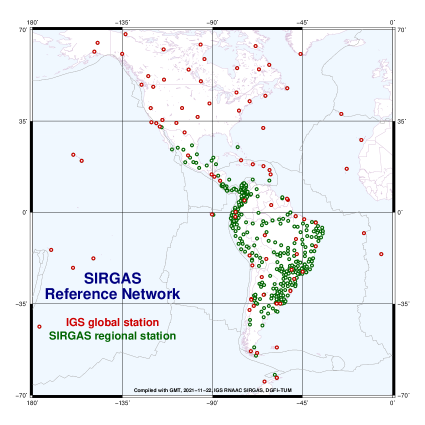
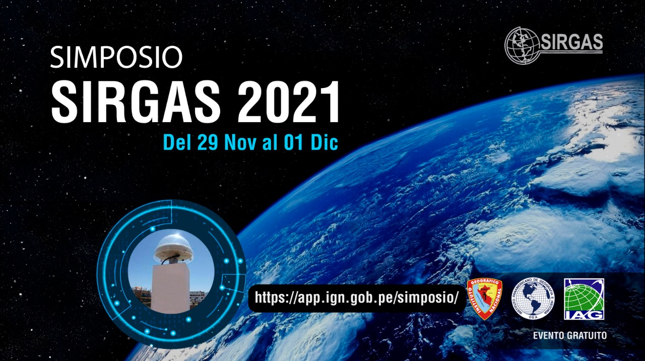
SIRGAS is the Geodetic Reference System for the Americas. Its definition corresponds to the International Terrestrial Reference System (ITRS) and it is realized by a regional densification of the International Terrestrial Reference Frame (ITRF) in the Americas. Besides the geometrical reference system, SIRGAS includes the definition and realization of a vertical reference system, based on ellipsoidal heights as geometrical component and geopotential numbers (referred to a global conventional W0 value) as physical component.

The RFIP Seminars are intended as a means to educate surveyors and other affiliated professions regarding the definition, maintenance and access to geometric and vertical reference frames, and their use and applications of GNSS for access. Additionally, appropriate standards, technology and tools are covered all as a part of education, training and capacity development.

Objective

While abbreviated in format, this seminar is intended to provide an overview of these topics in a virtual setting. To strengthen the advocacy and deliberation skills for geospatial experts and surveying professionals to effectively represent and communicate their positions and requirements to SIRGAS as a scientific body, the FIG as a professional organization and other professional fora. The focus will be on the surveying/geodetic/mapping needs from perspective of surveyor/practioner

Target Audience

Surveyors, GIS professionals, and other technical and professional representatives of Americas region.

Format

This side event will be hosted via the GoToWebinar platform on December 2 2021 between 18:00 and 20:00 UTC. It will comprise a series of presentations, a breakout groups exercise, panel discussion session, open discussion and closing remarks. The event will be conducted in English with Spanish translation on an ad hoc basis.

Registration URL https://attendee.gotowebinar.com/register/8207982263965818379

Webinar ID 771-993-987

Convenors

FIG Commission 5:

  • Dr. Daniel Roman (Chair)
  • Dr. Kevin Ahlgren (Vice-Chair-Administration)
  • Mr. David Avalos (Vice-Chair Vertical Reference Frames)

SIRGAS:

  • Dr. Demian Gomez (President WG II)
  • Dr. Dana Caccamise (U.S. rep. To WG II)

Times (UTC)

Discussion Area

Presenters

18:00-18:05
Welcome and Opening Remarks
Dr. Daniel Roman
18:05-18:20
FIG Overview
Dr. Daniel Roman

Mr. David Avalos

18:20-18:30
SIRGAS Overview
Dr. Demian Gomez
18:30-18:40
Bolivia: National Perspective
Dr. Arturo Echelar
18:40-18:50
Canada: Canadian Institute of Geomatics
Dr. Mir Abolfazl Mostafavi
18:50-19:00
French Guiana: Ordre des Géomètres-Experts
M. Paul Chambon
19:00-19:10
Jamaica: Land Surveyors Association of Jamaica
Mr. Christopher Grant
19:10-19:20
Trinidad and Tobago: Institute of Surveyors of Trinidad and Tobago
Dr. Dexter Davis
19:20-19:40
Discussion
All Participants
19:40-19:50
Future Seminars
Dr. Daniel Roman
19:50-20:00
Closing Remarks
Dr. Demian Gomez

Dr. Daniel Roman


2021 SIRGAS Symposium

A new edition of the SIRGAS Symposium will take place from November 29 to December 1, 2021. The main goal of the 2021 SIRGAS Symposium is to convene the geodetic community of the Americas and the Caribbean to exchange experiences and progress, as well as discuss new projects related to the implementation, maintenance, and use of the geodetic reference infrastructure in the region.

Due to the CoVID-19 pandemic, the 2021 SIRGAS Symposium will be held virtually through the Zoom platform. The event will be free of charge with English and Spanish simultaneous translation.

Although the SIRGAS Symposiums are mainly attended by National Representatives, members of the Working Groups and projects, these events are open to the entire international geodetic community, and therefore we cordially invite:

  • Representatives of regional organizations involved in the publication of geospatial information and Earth observations;
  • Representatives of national institutions responsible for the definition of geodetic reference frames;
  • Representatives of public and private agencies that use geodetic and geophysical information;
  • Representatives of universities and research centers on topics related to geodesy and geophysics; and
  • Scientists, professionals, technicians and students whose activities and research are related to SIRGAS.

The activities of the SIRGAS 2021 Symposium will be carried out in 5 sessions:

  • November 29 – Report of the SIRGAS authorities: President of SIRGAS, Presidents of the SIRGAS Working Groups and update of the GRFA of UN-GGIM: Americas;
  • November 29 – Development and maintenance of the SIRGAS reference frame;
  • November 30 – Modeling of the Earth’s gravity field (geoid, gravimetry, international reference system of heights);
  • November 30 – Applications of the SIRGAS reference frame (national reports, real-time applications, etc.); Y
  • December 1 – SIRGAS contributions to the modeling of the Earth System (troposphere, ionosphere, seismology, oceanography and hydrography).

There are two presentation types:

  • Oral presentations with a total presentation time of 15 minutes; and
  • Posters: available for download in PDF format, and will be presented orally in 5 minutes.

The 2021 SIRGAS Symposium is being organized by the Local Organizing Committee, composed by the Executive Committee of SIRGAS and representatives of the National Geographic Institute of Peru.  For any questions about the venue please contact sirgas2021@ign.gob.pe. This event has the support of the International Association of Geodesy and the Pan American Institute of Geography and History. For more details, visit the event website https://app.ign.gob.pe/simposio/

Finally, we would like to announce that the Journal of Geodetic Science (JoGS) is developing a special issue related to the 2021 SIRGAS Symposium, and therefore we invite front-line researchers and technological community to submit original research and review articles focused on Geodesy and Earth Sciences for its inclusion in this special issue of the journal. All manuscripts (research and review papers) should be submitted online at https://www.degruyter.com/journal/key/jogs/html. For more information download the call for papers.

New Experimental Processing Center SIRGAS in Costa Rica

The National Geographic Institute of Costa Rica (IGN-CR) begins activities as an Experimental Processing Center SIRGAS from GPS week 2170 (August 8, 2021). The main characteristics of this new Experimental Center are:

Name: National Geographic Institute of Costa Rica
Abbreviation: CRI
Processed stations: AACR ALEC AMCR BEJA BNGA BOAV BOGT BQLA CANO CIQE CJ01 CN19 COEC CRLP CRO1 DARI DPEC ECEC EPEC GLPS GUAT HC03 HV01 ICEP IDGO INEG LIBE LIMN LJEC LMMF LR01 MANA MERI MOTE MTY2 NAS0 NEIL NYCO PMEC POPA POVE PREC PUNT RIDC RIOP SAGE SCUB SNSN TAMP TEG2 TPEC TUNA UC01 UCRI VERA VIL2 VIVI ZARZ
Software: Bernese GNSS Software V. 5.2

With this new experimental processing center, SIRGAS is approaching the goal of having a scientific GNSS data processing center in each country in the region. SIRGAS thanks IGN-Pe for this initiative and for its continued support in all activities related to the establishment, maintenance, and development of the reference framework for the Americas.

New technical guides on the International Heights Reference Frame

Due to the objectives that SIRGAS carries out through its Working Group III to contribute to the development of regional geodesy, two technical guides on the International Heights Reference Frame (IHRF) have been published.

The first document developed by the Working Group III is called “Guidelines for IHRF station selection” and describes requirements and recommendations for the selection and implementation of an IHRF station. The guide is aimed at institutions that already have a station planned in the calculation of the first IHRF implementation, and at agencies that wish to propose new stations to integrate into the IHRF.

The second document is entitled “Guidelines for performing gravimetric measurements around IHRF stations” and describes the relevant requirements and recommendations for making land gravimetric measurements around IHRF stations through the use of relative gravimeters.

Both documents were developed in Spanish, Portuguese and English, and can be downloaded from the SIRGAS website: https://sirgas.ipgh.org/recursos/guias/