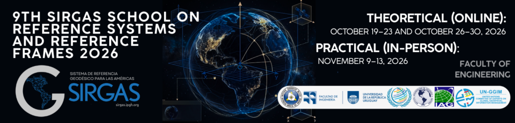
SIRGAS

Loading

SIRGAS

SIRGAS: Geodetic Reference System for the Americas

SIRGAS is a pan-American organization made up of regional government geodesy and cartography agencies, universities and research centers, which has the objective of defining and maintaining a continental geocentric reference frame, a unified vertical reference system, a gravimetric geoid model, and a continental network of absolute gravity.

Last News

About Us

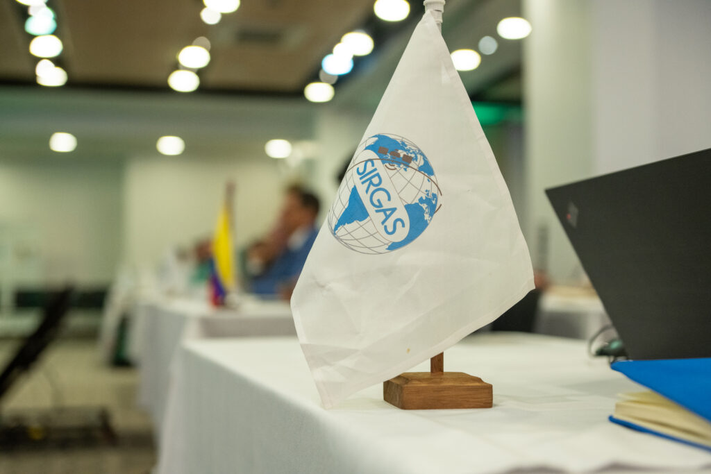
SIRGAS (Geodetic Reference System for the Americas) is the organization responsible for defining and maintaining the official geodetic reference framework in the Americas and the Caribbean, in accordance with international standards. Its system is compatible with the International Terrestrial Reference System (ITRS) and constitutes its regional densification, enabling the precise determination of positions and elevations.

Since its creation in 1993, SIRGAS has evolved as a Pan-American initiative driven by international organizations and national agencies, establishing itself as a key component of the region’s geospatial infrastructure. In addition to the geometric system, it develops a vertical reference system based on the Earth’s gravity field.

SIRGAS integrates governmental, academic, and scientific institutions and works in coordination with international organizations to support navigation, mapping, geoscience research, and sustainable development. Its operation is based on regional cooperation and an active network of experts committed to strengthening geodetic capabilities in the Americas.

Schools

SIRGAS develops schools that facilitate the exchange of knowledge in geodesy.

Symposium

SIRGAS promotes symposia that foster the exchange of knowledge in geodesy.

Training Workshops

SIRGAS promotes training and education spaces that foster the exchange of knowledge and experiences in geodesy.

Members
0 +
Events
0 +
Professionals
0 +
Countries
0 +

SIRGAS develops courses and training programs that promote the exchange of knowledge in the field of geodesy.

The image is from the SIRGAS 2024 Symposium held in Bogotá, Colombia.

Events and training 2027

ICCC Workshop Geodesy for Climate Research - 23 February 2027 - 25 February 2027

The 4. ICCC Workshop on Geodesy for Climate Research will take place as a hybrid event in Potsdam, Germany and online everywhere. More information to follow in spring 2026.

LINK

Events and training 2026

The 14th General Meeting of the International VLBI Service for Geodesy and Astrometry (IVS GM2026) Linking the Celestial and Terrestrial Realms April 12-17, 2026

Download of the Group Foto

We are pleased to announce that the fourteenth General Meeting of the International VLBI Service for Geodesy and Astrometry (IVS GM2026) will be held during the week of April 12-17, 2026, in Garmisch-Partenkirchen in the Bavarian Alps. All IVS Associate Members and individuals who have interests in the application of VLBI in the fields of geodesy, Earth sciences, astrometry, and other astronomical applications in geodesy are invited to attend the meeting.

The International VLBI Service for Geodesy and Astrometry (IVS) holds a General Meeting every two years. The purpose of the General Meeting is to assemble representatives from all IVS components to share information, hear reports, and plan future activities. The meeting also provides a forum for interaction with other members of the VLBI and Earth science communities.

In addition to the General Meeting, an IVS Analysis Workshop and an IVS Directing Board meeting will be held.

Hosting institutions

Research Facility Satellite Geodesy at the Technical University of Munich (TUM) in cooperation with the Chair of Astronomy and the Earth Observation Research Cluster of the Julius- Maximilians-Universität Würzburg

Important dates

  •   First Announcement: August 31, 2025
  •   Second Announcement: November 19, 2025
  •   Abstract submission deadline: January 30, 2026 extended to February 10, 2026
  •   Early-bird deadline: February 1, 2026 extended to February 10, 2026
  •   Registration deadline: March 1, 2026 extended to April 1, 2026

Contact information

LOC: Alexander Neidhardt (Chair), Stefanie Daurer, Chanye Fu, Urs Hugentobler, Matthias Kadler, Florian Kroner, Simon Seidl, Martin Brandl, Till Rehm, Theresa Lohbinger (with kind personnel support from Federal Agency for Cartography and Geodesy (BKG) to represent the Geodetic Observatory Wettzell)

PC: IVS-gm-pc <ivs-gm-pc@lists.nasa.gov>

Dirk Behrend, Chris Dieck, Rüdiger Haas, Masafumi Ishigaki, Chris Jacobs, Matthias Kadler, Pepe Lopez-Perez, Lucia McCallum, Alexander Neidhardt, Fengchun Shu, Benedikt Soja, Chet Ruszczyk, Tobias Ullmann, Alet de Witt

Más Información: LINK

International Scientific Conference 15 April | 09:00 EEST

This Scientific Conference is dedicated to the study of the Earth’s internal and external processes, as well as their interaction with the space environment. It will cover research on the dynamics of the Earth’s crust and mantle, tectonic processes, seismicity, variations in the gravitational and magnetic fields, as well as the application of satellite observations and geodetic methods. The section brings together theoretical and applied studies, promoting interdisciplinary collaboration among geophysics, geology, geodesy, and space sciences.

Geodynamucs_and_Geospatial_Research_Draft_Agenda

LINK

 The Workshop Topics

•        Observed trends and long-term variations in the middle atmosphere

•        Modeled and predicted trends and long-term variations in the middle atmosphere

•        Trends and long-term changes in the ionosphere and thermosphere

•        Dynamic, physical, chemical, and radiative mechanisms of trends and long-term variations

•        Role of the middle atmosphere for climate

•        Miscellaneous

 Abstract Submission and Registration

•       To submit the abstract, please click the ‘ABSTRACT SUBMISSION‘ button on the left panel.

•       To register and pay registration fees, please click here to access the registration system.

* Note: Abstract submission and registration are on two different systems. Please sign up separately, using the same username and email address.

•       Registration fees are as follows:

Early birds: 2500 RMB (about 350$) for staff (including postdocs), and 2000 RMB (about 280$) for students and retirees.

After March 31, 2026 (included): 3200 RMB (about 450$) for staff (including postdocs), and 2700 RMB (about 380$) for students and retirees.

* Note: Registration fees include the workshop expense, coffee breaks, buffet lunches, and the gala dinner.

 Travel Support Application

Our committee will support the travel expenses for a portion of students, early-career scientists, and female scientists participating in the workshop on-site. Special attention will be given to young scientists from developing countries during the selection. If you are interested, please complete the application form here before the deadline. We will notify the application result in late March 2026.

 Important Dates

28 Oct 2025Online abstract submission, registration, and travel support application open
16 Jan 2026Travel support application deadline
20 Feb 2026Abstract submission deadline (Extended)
31 Mar 2026Early bird registration deadline

Más información: LINK

2026 GEO Symposium / GEO-21 Plenary - 26-28 May 26

We cordially invite you to participate in the 2026 GEO Symposium and GEO-21 Plenary, to be held in Geneva, Switzerland, from 26 to 28 May 2026! 

Held under the theme “Investing in Earth Intelligence for a Resilient Future,” the 2026 GEO Symposium and GEO-21 Plenary will convene governments, space agencies, research organizations, private sector innovators, and development partners to explore how Earth Intelligence can drive transformative, resilient solutions for people and the planet at a pivotal moment in the implementation of GEO’s Post-2025 Strategy.

Location: World Meteorological Organization (WMO), 7bis, avenue de la Paix, 211 Geneva 2 – Switzerland

Más Información: LINK

IGS 2026 Workshop- From 1 to 5 June


Chile – where the crust trembles daily and even a traditional cocktail is nicknamed the “Earthquake” – will become the epicenter of an unprecedented scientific gathering in South America.

From 1 to 5 June 2026, the IGS Workshop 2026 will bring the GNSS and geodesy community to Santiago (Chile).

Organized by the University of Santiago de Chile (USACH) with the Military Geographic Institute (IGM), the workshop will showcase the latest breakthroughs of the International GNSS Service (IGS).

Stay tuned for updates and secure your seat at IGS Workshop 2026: Chile, epicenter of GNSS orbits – driving global geodesy!

Workshop updates (abstract submission and registration opening, deadlines, etc.) will be broadcast through the usual geodesy mailing lists. To have them sent directly to you, please fill out this interest form: https://forms.gle/GTVaesFRgmiA3qbW8.

Info: https://www.igs-workshop-2026.com/

https://igs.org/workshop/2026/

EU-wide Community Workshop on Quantum Gravimetry - 3 June - 5 June

This in-person workshop is organized with the main objective to obtain feedback by the entire European community. Opinions, comments and thoughts on EQUIP-G project activities will contribute to shaping key aspects on the future of (terrestrial) gravimetry. This is centered around the main long-term goal to establish a permanent perennial entity of a shared park of quantum gravimeters in Europe.

The workshop is addressed to all interested and relevant person from EU policymaker to European companies and geophysical service providers and different communities (geodesy, quantum sensing, metrology, geosciences and defense). We want to underline that the focus area is Europe.

Participants will be informed not only about the project structure and goals but about finished, ongoing and planned activities, spanning the entire scope of the project. The workshop involves various formats (presentations, panel discussions, display area, break-out activities and discussions).

Join, be active and enjoy this workshop which is organized for all of us!

Event website and registration: https://events.spacepole.be/event/268/
Project website: https://www.equip-g.eu/

LINK

EUREF Symposium 2026 June 23-25, 2026 Paris, France

EUREF is the International Association of Geodesy (IAG) Reference Frame Sub-Commission for Europe. The EUREF Symposium has been organized since 1990 and the scope of the symposium covers EUREF activities, such as the realisation, maintenance, and usage of ETRS89, EVRS and the EUREF Permanent Network.

Key information

  • This conference is in-person only.
  • Registration is mandatory to submit an abstract.
  • Early-bird registration deadline: April 23, 2026
  • Abstract submission deadline: April 23, 2026
  • Registration will open soon!

Organisers

Más Información: LINK

IDS Workshop, Wiesbaden, Germany, 23-25 June 2026

The 2026 IDS Workshop will take place in Wiesbaden, Germany, from 23 to 25 June 2026, in conjunction with 2026 OSTST meeting. The event is organized by Eumetsat, Copernicus and CNES.

The workshop will highlight recent developments and the current status of scientific results based on DORIS data. It will also provide a forum for discussion and coordination of future activities within the IDS community. 

The abstract submission period is open until April 3rd on the website https://idsworkshop.aviso.altimetry.fr/

For logistical information (registration, venue, …) please go to https://www.eventsforce.net/ostst2026

Call for abstracts
Contributors are invited to submit an oral presentation or poster on topics within the scientific scope of the IDS, with particular emphasis on the following key areas: 

  • The DORIS system: network, space segment, and future prospects
  • IDS data centers
  • Precise orbit determination using DORIS
  • Force modeling for DORIS satellites
  • Contribution of DORIS to global terrestrial reference frames
  • Near-real-time applications of DORIS data
  • Estimation of Earth rotation parameters using DORIS
  • Genesis-related studies
  • DORIS data analysis at IDS centers (ACs, AACs, CC)
  • DORIS clock modeling
  • DORIS troposphere modeling
  • Other DORIS-related applications and studies within the scientific scope of IDS are also welcome 

Workshop sessions will be defined at a later stage, taking into account the accepted abstracts.

The Scientific Committee
Petr Štěpánek (GOP, Czech Republic) chair 
Patrick Schreiner (GFZ, Germany)
Ningbo Wang (AIR CAS, China)
Samuel Nahmani (IGN, France)
Hugues Capdeville (CLS, France)
Maria Tsakiri (NTUA, Greece)
Jean-Michel Lemoine (CNES, France)

Más Información: LINK

ICERS 2026, 1st - 3rd July 2026, Zagreb, Croatia

Following the successful and inspiring International Conference of Environmental Remote Sensing and GIS held in 2024, we are proud to invite you to join us at the second ICERS Conference in 2026. Having set high standards in knowledge exchange, we will once again bring together a global community of experts, academics, and enthusiasts in July 2026. ICERS serves as a unique meeting point for sharing the latest advancements and applied solutions in the fields of remote sensing and GIS, offering fresh perspectives on addressing complex environmental challenges. Special emphasis will be placed on geospatial solutions for climate change, sustainable development, and effective resource management. We invite you to engage in dynamic discussions shaping the future of our planet, with a particular focus on the transformative power of geospatial data. This conference provides an ideal platform for collaboration, strengthening partnerships, and presenting your latest research activities and projects at the global level. Announcement and call document.

Conference deadlines:

  • 1st February 2026 1st March 2026 – Abstract submission
  • 1st April 2026 – Full paper submission (up to 8 pages)
  • 1st May 2026 – Registration
  • 1st – 3rd July 2026 – ICERS Conference (Zagreb, Croatia)

Conference topics:

  • Remote Sensing for Environmental Monitoring
  • GIS for Sustainable Development
  • Disaster Management and Response
  • Conservation and Biodiversity
  • Innovations in spatial data-acquiring technologies
  • Multicriteria decision-making and GIS
  • Climate Change mitigation politics
  • Data interoperability
  • Artificial intelligence and big data

Conference date: 1st – 3rd July 2026

Conference venue: National and University Library, Hrvatske bratske zajednice 4, Zagreb, Croatia (45°47’48.2″N 15°58’39.1″E)

Organizer: University of Zagreb Faculty of Geodesy

Language: English

Conference fee:

Regular
€ 275,00 (VAT included)*
Student
€ 185,00 (VAT included)*


*The fee includes access to all sessions, access to the exhibition hall, daily b2b networking, lunch, coffee and a certificate of attendance.

Más Información: LINK

17th European VLBI Network Symposium and Users' Meeting - 14-18 September 2026.

Meeting Overview

The 17th European VLBI Network Symposium and Users’ Meeting will be hosted by Jodrell Bank Centre for Astrophysics, The University of Manchester, United Kingdom, from 14-18 September 2026.

The main venue will be the Department of Physics and Astronomy’s Schuster Building – including the Ernest Rutherford and Jocelyn Bell-Burnell theatres.

The European VLBI Network Symposium is the main forum for discussion of the latest Very Long Baseline Interferometry scientific results and technical and technological developments within the EVN member countries. The purpose of this biennal meeting is to bring together the global VLBI community to exchange knowledge, share new research, educate members on advancements in VLBI techniques, and foster a collaborative community in radio astronomy. We expect to be able to host up to 200 participants in September 2026 so please register early.

List of Topics

  • Stellar evolution, AGNs and SMBHs
  • VLBI at low frequencies
  • Transients, pulsars and multi-messenger astrophysics
  • VLBI techniques and instrumentation
  • SKA-VLBI synergies and next generation facilities
  • Astrometry, geodesy and space applications
  • EVN users meeting

Organisers

Scientific Organising Committee (SOC)

  • Jack Radcliffe (Chair; The University of Manchester)
  • Pikky Atri (Netherlands Institute for Radio Astronomy; ASTRON/Radboud University)
  • Olga Bayandina (Square Kilometre Array Observatory; SKAO)
  • Michael Janssen (Radboud University/Max-Planck-Institut für Radioastronomie)
  • Yuri Kovalev (Max-Planck-Institut für Radioastronomie)
  • Hana Krásná (Technische Universität Wien; TU Wien)
  • Mar Mezcua (Institut de Ciències de l’Espai; ICE-CSIC/Institut d’Estudis Espacials de Catalunya; IEEC)
  • Zsolt Paragi (Joint Institute for VLBI in Europe; JIV-ERIC)
  • Jongho Park (Kyung Hee University)
  • Cristiana Spingola (Istituto Nazionale di Astrofisica; INAF)
  • Agnieszka Słowikowska (Joint Institute for VLBI in Europe; JIV-ERIC)
  • Ailing Wang (Institute of High Energy Physics, Chinese Academy of Sciences)

Local Organising Committee (LOC)

  • Emmanuel Bempong-Manful (Chair; Manchester/e-MERLIN)
  • Robert Beswick (Co-chair; Manchester/ukSRC)
  • Simon Garrington (Co-chair; Manchester)
  • Justin Bray (Manchester/e-MERLIN)
  • Andrew Gordon (Manchester/ukSRC)
  • Alastair Gunn (Manchester)
  • Julia Healy (Manchester/ukSRC)
  • Anthony Holloway (Manchester)
  • Laura Knighton (Manchester)
  • Sarah Lamb (SKAO)
  • Sarah Morris (Manchester)
  • Tom Muxlow (Manchester)
  • Jack Radcliffe (Manchester/ukSRC)
  • Emma Thomas (Manchester)
  • David Williams-Baldwin (Manchester/e-MERLIN)

Más Información: LINK

ITGRF Workshop 2026 14 September | 12:00 - 16 September | 13:00 UTC

The 2026 ITGRF workshop will provide an excellent opportunity to advance the International Terrestrial Gravity Reference Frame and to discuss current activities within the IAG Joint Working Group 2.1.1. The workshop will focus on ensuring the compatibility of absolute gravity observations, establishing and maintaining gravity reference stations, and developing a modern, user-oriented infrastructure for end-users. It will bring together experts in absolute gravimetrygravity monitoring, and reference frame realization to exchange knowledge and coordinate future work.

The International Terrestrial Gravity Reference Frame (ITGRF) is developed by the International Association of Geodesy and is based on accurate observations from absolute gravimeters and continuous gravity monitoring at reference stations. Its primary objective is to replace the obsolete International Gravity Reference Standardization Network (IGSN71) defined in the early 1970s with a modern, consistent global gravity reference.

The workshop will be hosted in 2026 by the British Geological Survey’s Space Geodesy Facility at Herstmonceux Castle in East Sussex, a site with a strong scientific heritage as the former home of the Royal Greenwich Observatory.

More info here [PDF]

Booking/registration information is not yet available and will follow soon.

LINK

VieVS Days 2026 15 September - 16 September

The two-day workshop will cover the basics of analysing VLBI geodetic data, simulations and scheduling. Participants will have the opportunity to apply their learning through hands-on exercises utilising VieVS & VieSched++.

The workshop is aimed at PhD students and newcomers to the field of geodetic VLBI analysis. The registration is offered on a first-come, first-served basis. The number of participants is limited.

More info and registration here: https://vievswiki.geo.tuwien.ac.at/Webinar/VieVSWorkshop2026

Más información: LINK

TIGER Symposium in Geodesy - September 28th to October 1st, 2026.

The TIGER Symposium in Geodesy is the official symposium of the International Association of Geodesy (IAG) Commission 3 on Earth rotation and geodynamics. TIGER stands for Tracking and Investigating Geodynamics and Earth Rotation. The 2026 edition will mark the very first meeting of IAG Commission 3 – September 28th to October 1st, 2026.

Commission 3 studies the entire range of physical processes associated with the movement and deformation of the Earth in response to both external and internal forces. In addition to the core focus of Commission 3, the TIGER Symposium will also highlight themes traditionally addressed at the Journées meetings. The TIGER Symposium in Geodesy is also supported by the International Earth Rotation & Reference System Service (IERS), a service of IAG contributing to global reference systems and Earth orientation science.

To foster collaboration across disciplines, IAG Commission 3 works closely with several other IUGG associations – International Association of Volcanology and Chemistry of the Earth’s Interior (IAVCEI)International Association of Cryospheric Sciences (IACS), and International Association of Seismology and Physics of the Earth’s Interior (IASPEI) – through a number of joint sub-commissions, making the TIGER Symposium a place where different geoscientific communities can come together and share and discuss their work.

Following the TIGER Symposium in Geodesy, two more meetings will be arranged in Gävle:
GGOS Topical Meeting on Geohazards, October 2nd, 2026
GGOS Days 2026, October 5th to 7th, 2026

Lantmäteriet is proud to host all these meetings in Gävle (Sweden).


Topics

Contributions on the following topics are welcome:

  • Earth rotation (measurement techniques, short vs. long-term variations, climate and angular momentum, core-mantle interactions, atmosphere-ocean-hydrology effects, reference frame links, space geodesy synergies, prediction models at various time scales, interactions between EOP and geophysical models, …) – see the subcommission and working group websites for more details
  • Earth tides (solid Earth tides, ocean tide and non-tidal loading, atmospheric loading, hydrological loading, tidal dissipation, earth rheology, tidal measurements (instruments), pole tides, Moon tides, …) – see the subcommission website for more details
  • Cryospheric and hydrologic deformation (ice mass loss, glacier dynamics, grounding line migration, ice–ocean–Earth coupling, sea-level impacts, polar GNSS networks, glacial isostatic adjustment, Earth rheology, climate model links, seismicity, …) – see the subcommissionstudy group and working group websites for more details
  • Volcanogeodesy (GNSS & InSAR monitoring, magma source modeling, early warning systems, multi-sensor integration, real-time monitoring, volcano-tectonic links, submarine volcanism, hazard assessment, …) – see the subcommission website for more details
  • Seismogeodesy (co-seismic monitoring, post-seismic deformation, GNSS-seismic-InSAR integration, finite-fault modeling, tsunami warning, strain accumulation, …) – see the subcommission website for more details

Más Información: LINK

GGOS Days 2026 Oct. 5-7, 2026

GGOS Days 2026

Oct. 5-7, 2026

more info coming soon …

Más Información: LINK

Gravity Geoid and Height Systems Symposium (GGHS2026) 12 October - 16 October

The GravityGeoid and Height Systems Symposium (GGHS) is a leading international meeting organized under the International Association of Geodesy (IAG). It brings together experts, researchers, and students to discuss the latest developments in gravity field modeling, geoid determination, height systems, and their applications in Earth sciences and society.

The next edition, GGHS2026, will continue this tradition by providing a forum for exchanging ideas, presenting new research, and fostering collaboration across the global geodetic community.

The official website with full details will be available soon.

LINK

SIRGAS Symposium 2026 3 November - 6 November

Deadlines

Abstract Deadline: 28.08.2026

Registration Deadline: 28.08.2026

The SIRGAS Biennial Symposium is a leading international forum that brings together geodesists, geophysicists, researchers, and professionals from across the Americas and beyond to discuss advances in geodetic reference systems and Earth observation.

🗓 Frequency & Duration
Held every two years, the Symposium spans four days of scientific exchange, featuring oral presentations, technical sessions, and discussions focused on both theoretical developments and practical applications.

📍 Host City
The next edition will take place in Montevideo, Uruguay, offering a unique setting that combines scientific excellence with regional collaboration.

🔬 Main Thematic Axes

  1. Applications of the SIRGAS Reference Framework
    Practical and scientific uses of SIRGAS in positioning, mapping, geodynamics, and geospatial infrastructure.
  2. SIRGAS Contributions to Earth System Modelling
    The role of SIRGAS in understanding Earth dynamics, including tectonics, sea level, and climate-related processes.
  3. Development and Maintenance of the SIRGAS Reference Framework
    Advances in GNSS networks, reference frames, standards, and long-term sustainability.
  4. Modelling the Earth’s Gravity Field
    Gravity field determination, geoid modelling, and their applications in science and engineering.

🌎 Why Attend?
The Symposium fosters regional integrationknowledge exchange, and capacity building, strengthening SIRGAS as the geodetic reference for the Americas.

🔗 More information and updates will be available soon on https://sirgas.ipgh.org/

Events and training 2025

Dates: June 3, 5, 6, 10 and 12 - Virtual School: "Terrestrial Reference Frame. Geodynamic and Atmospheric Monitoring 2025"

Dates: June 3, 5, 6, 10, and 12, 2025.

UTC Time -03:00

  • Tuesday, June 3, 2025 – 9:00 AM to 1:00 PM
  • Thursday, June 5, 2025 – 9:00 AM to 12:50 PM
  • Friday, June 6, 2025 – 9:00 AM to 12:50 PM
  • Tuesday, June 10, 2025 – 9:00 AM to 1:00 PM
  • Thursday, June 12, 2025 – 9:00 AM to 12:55 PM

Location: Virtual; once 500 seats are filled, the event will be streamed on YouTube.

Broadcast: English and Spanish

YouTube: SIRGAS

Course Objective: The objective of the 2025 School is to provide the most important concepts on the definition, implementation, and maintenance of global, continental, and national reference frameworks, as well as their importance in various applications. It will also address advances in Earth System monitoring in response to the challenges posed by climate change, which is already affecting us and impacting our most vulnerable societies.

Virtual School Registration: Here.
Virtual School Registration Deadline: May 24, 2025.

14/07 to 18/07 - Advanced Processing of Space Geodesy Data with BSW 5.4: GNSS Techniques and Nonlinear Models

From July 14 to 18, 2025, the SIRGAS course “Advanced Processing of Spatial Geodesy Data with BSW 5.4: GNSS Techniques and Non-Lineal Models” will be held.

It will take place at the University of Costa Rica in San José, Costa Rica. The course will be carried out in person and will only be taught in Spanish.

A five-day course for advanced professionals, young scientists and employees of national agencies, with the fundamental themes of the SIRGAS campaign process with BSW 5.4 and Non-Lineal Models, Cinematic Reference Frameworks.

Registration Here

Registration deadline: June 15, 2025.

October 27 to November 1 - XVI SIRGAS School "VLBI and SLR Data Processing"


XVI SIRGAS School “VLBI and SLR Data Processing”

The XVI SIRGAS School will be held in the beautiful city of San Juan, Argentina, with the aim of training professionals in the field of geodesy through the processing of VLBI (Very Long Baseline Interferometry) and SLR (Satellite Laser Ranging) data, key techniques for the definition of global reference frames.

🗓️ Dates: From Monday, October 27 to Saturday, November 1, 2025

📍 Location: San Juan, Argentina.

🎯 Course Objective:

The purpose of this course is to provide the theoretical concepts and practical tools necessary for the analysis and processing of VLBI and SLR techniques, delving into their application in the definition and maintenance of geodetic reference frames.

👥Addressed to:

    • Graduates in geodesy and related fields
    • Scientists specializing in geodesy
    • Employees of national mapping agencies
    • Students interested in geodesy and space technology

Allocation of Places for the XVI SIRGAS School

The SIRGAS Executive Committee will have 10 special spots, which will be assigned among the 50 participants selected to attend the UN-GGCE Workshop.

These positions will be assigned based on academic profile, professional experience, and commitment to strengthening geodesy in the region.

👉 Registration Form – XVI SIRGAS School

Registration deadline for the XVI SIRGAS School: Friday, May 9, 2025

📌 Registration:

Those interested must complete the Registration Form to confirm their participation. Registration is also required for the UN-GGCE Workshop: Capacity Building in Geodesy, in Santiago, Chile.

👉Registration – UN-GGCE Workshop

UN-GGCE Workshop registration deadline: Tuesday, April 29, 2025

03/11 - 7/11 - Geodesy Capacity Building Workshop, Santiago, Chile


The next Geodesy Capacity Development Workshop for the Americas will be held in person from November 3-7, 2025, in Santiago, Chile.

This workshop seeks to strengthen the geodetic capacities of Member States in the region, supporting the transition to a modern Geospatial Reference System. The program will include practical sessions, expert discussions, networking opportunities, and the development of national roadmaps, among other key activities.

The United Nations Global Geodetic Centre of Excellence (UN-GGCE) invites surveying and geodesy professionals working for, or in collaboration with, government agencies of Member States in the Americas region to participate in its Geodesy Capacity Development Workshop, which will be held in Santiago, Chile. This workshop aims to help participants understand how to collaborate with government colleagues to transition to a modern Geospatial Reference System (GRS).

At the following link, you will find a Concept Note that provides additional information on the workshop objectives, provisional agenda, target audience, and application process.

Link: Concept Note

Application Form: Here 

Application Deadline: The deadline to complete the online application form and submit the required reference letters is April 29, 2025, at 6:00 PM CEST.

Please note that this workshop is intended for surveying and geodesy professionals working for, or in collaboration with, government agencies of Member States in the Americas region. A workshop for the Arab States region is currently under development and will take place later in 2025. We will provide more information about this workshop in the coming months.

Events and training 2024

12/11 - "Real Time" School, Bogotá, Colombia

From November 12 to 15, 2024, the third SIRGAS “Tiempo Real” School will be held. The School is organized jointly with the Agustín Codazzi Geographic Institute, in Bogotá, Colombia.

The School will take place in person at the Faculty of Engineering of the Francisco José de Caldas District University, LatitUD Laboratories – Cadastral Engineering and Geodesy, Carrera 7 # 40B-57, 4th floor.

More Information: “Tiempo Real” School

18/11 - SIRGAS 2024 Symposium, Bogotá, Colombia

The SIRGAS 2024 Symposium is scheduled to take place in Bogotá, Colombia from November 18 to 21, 2024.

The SIRGAS Executive Committee is pleased to invite the entire Scientific and Technological Community related to Geodesy and Earth Sciences to participate in the SIRGAS 2024 Symposium.

More Information. Link

formulario de preinscripción vía el enlace: 

https://forms.gle/HYsAdAuJ4PuzvNXH9 

Events and training 2023

14/2 - Tour de l’IGS series

Se acerca la quinta edición de la serie Tour de l’IGS: GNSS para peligros naturales en el Pacífico Sur. Esta edición se centra en cómo las infraestructuras geodésicas y GNSS pueden respaldar los sistemas de alerta temprana para peligros naturales, en particular para las comunidades del Pacífico. El evento tendrá lugar en línea, el 14 de febrero de 2023 de 21:30 a 23:59 UTC.

La inscripción es gratuita y abierta a toda la comunidad. Regístrese antes del 9 de febrero de 2023 para acceder a este evento.

13/3 - Workshop in SAR for Geodesy

Le damos una calurosa bienvenida al Taller de SAR para Geodesia organizado en Otaniemi, Espoo, Finlandia y en Zoom 13. –14.3.2023.

Discutiremos las oportunidades y los desafíos del uso de la técnica del radar de apertura sintética (SAR) para la investigación y las aplicaciones geodésicas. Damos la bienvenida a contribuciones que discutan los usos de la técnica SAR para el posicionamiento absoluto o relativo, las oportunidades que están surgiendo en la combinación de técnicas, compartan el estado actual de la infraestructura o cualquier otra cosa relacionada con el tema. Nuestros oradores invitados incluyen a Ramon Hanssen (TU Delft), Thomas Gruber (TU Munich), Muriel Pinheiro (ESA) y Christoph Gisinger (DLR).

Para más información e inscripciones por favor visite:

Workshop in SAR for Geodesy | Aalto University


28/3 - ICCC Workshop 2023

Se acerca el segundo evento del Inter-Commission Committee on Geodesy for Climate Research (ICCC). El mismo tendrá lugar del 28 al 30 de marzo del 2023 y estará disponible de manera online.

Se encuentra abierta la convocatoria para la entrega de resúmenes y la registración al evento en el siguiente enlace IAG-ICCC 2023 workshop: abstract submission and registration. (office.com). El mismo es gratuito y abierto al público en general. Es posible entregar resúmenes hasta el 15 de marzo inclusive.

Este taller pretende:

1) Resaltar el potencial de la geodesia para la investigación del clima mostrando y discutiendo estudios relacionados con el clima que hacen uso de observaciones geodésicas.
2) Reunir a científicos geodésicos y climáticos para facilitar el intercambio de su experiencia y posiblemente establecer una cooperación mutua.

Más información acerca del evento visitando el siguiente enlace 2. ICCC Workshop 2023 – IAG ICCC (iag-aig.org).

24/5 - Simposio de EEUREF

El Simposio EUREF es el foro donde se discuten las actividades de EUREF y se toman las resoluciones. Se ha organizado todos los años desde 1990, con excepciones en 1991, cuando fue reemplazada por la ‘Reunión Común de las Subcomisiones IAG EUREF, UELN, CRCM-WE (Comisión sobre Movimientos Recientes de la Corteza, Subcomisión Europa Occidental) y CERCO -Grupo de Trabajo VIII- y 2020, cuando fue cancelado por la situación del COVID-19.

El simposio EUREF 2023 tendrá lugar en Gotemburgo, Suecia, de miércoles a viernes del 24 al 26 de mayo de 2023.

Más información del evento visitando el siguiente enlace: euref symposia.

28/5 - Semana de trabajo FIG 2023

Son invitados a la conferencia más grande y prestigiosa de profesionales de la agrimensura y ciencias geoespaciales, a realizarse en 2023 en Orlando, Florida, USA. Se espera la participación de alrededor de 2000 expertos en agrimensura y ciencias geoespaciales de todo el mundo.
La Federación Internacional de Agrimensores (FIG) es una organización profesional internacional no gubernamental reconocida por las Naciones Unidas y el Banco Mundial. FIG fue fundada en 1878 y representa a asociaciones nacionales de profesionales de agrimensura, topografía, catastro, avalúos, cartografía, expertos geoespaciales que trabajan en los sectores público, privado, así como la comunidad científica, académica y de investigación, e innovadores tecnológicos e industria de más de 120 países alrededor del mundo. Las organizaciones miembro miden, posicionan, mapean, ubican, tasan y valoran, estiman y presupuestan, planifican, construyen, desarrollan y administran la tierra, los mares y cualquier estructura hecha por el hombre con la visión de extender la utilidad de la topografía y la geodesia en beneficio de la sociedad, el ambiente y la economía.
Cada año, FIG convoca una conferencia en cooperación con una asociación miembro nacional. El tema general de la conferencia es Protegiendo nuestro mundo, conquistando nuevas fronteras, que refiere a la importancia de mirar hacia adelante y descubrir lo que se necesitará en el futuro para nuestra profesión y, al mismo tiempo, asegurarnos de preservar lo que hoy funciona bien.
El evento del año 2023 también contará con actividades sociales y turísticas para familiarizarse con Orlando y Florida, incluidos varios recorridos técnicos que permitirán visualizar cómo la región está trabajando aspectos y desafíos topográficos y geoespaciales.
La Semana de trabajo FIG 2023 brindará a los profesionales participantes la oportunidad de:
– Aprender globalmente – con la participación de alrededor de 80-90 países.
– Aprender a través de la experiencia de profesionales, académicos, empresas e industrias de otros países con sesiones y participación de la amplia gama de agrimensura y expertos geoespaciales.
– Generar impacto en carreras, organizaciones y comunidades.

Además, a modo de promover una amplia participación de países de habla hispana:
– Se contará con servicios de traducción del inglés al español para actividades de primer nivel, tales como:
• Presentaciones plenarias.
• Actualización de la modernización del Sistema Nacional de Referencia Espacial de Estados Unidos.
– Se ofrecerán sesiones en español:
• Resúmenes y artículos escritos en español (artículos no revisados por pares).
• Sesiones especiales se realizarán en español.
– Eventos previos que incluyen seminarios sobre marcos de referencia en la práctica y sesiones para jóvenes agrimensores.

Más información sobre el evento disponible en:

Invitation to FIG Working Week 2023 in Orlando, USA

11/6 - IUGG Berlín 2023

La 28ª Asamblea General de la IUGG (IUGG2023) se llevará a cabo del 11 al 20 de julio de 2023 en el CityCube de Berlín, Alemania.
Esta Asamblea General es una oportunidad especial para que los participantes de todo el mundo se reúnan y discutan la gama completa de temas geodésicos y geofísicos, y mejoren aún más la importante colaboración interdisciplinaria para una mejor comprensión de nuestro Sistema Terrestre. IUGG2023 proporcionará una plataforma para reuniones personales, intercambio de ideas y desarrollo de nuevos conceptos para la colaboración científica internacional, todo lo cual ha sufrido un revés durante esta crisis pandémica. IUGG2023 ayudará a crear un nuevo espíritu para abordar los grandes desafíos sociales apremiantes, como el cambio ambiental global y los peligros naturales, y para estimular la investigación geocientífica novedosa.

Para más información acerca del evento, visite el siguiente link IUGG 2023 Berlin | Welcome.

3/7 - 8ª Escuela SIRGAS en Sistemas de Referencia

Del 3 al 7 de julio de 2023 se realizará la 8ª Escuela SIRGAS sobre “Sistema de Referencia”. La Escuela tendrá lugar en la Universidad de Costa Rica y Universidad Nacional, en San José y Heredia, Costa Rica. La Escuela se llevará a cabo de manera presencial y se impartirá únicamente en español.

Un curso de cinco días para profesionales avanzados, jóvenes científicos y empleados de agencias nacionales con los temas fundamentales de la geodesia física y geométrica. La escuela se dividirá en dos bloques: teórico (dos días y medio) y práctico (dos días y medio). Durante el bloque de prácticas se desarrollarán los temas necesarios para el procesamiento y ajuste de redes GPS/GNSS con paquetes BERNESE y GAMIT/GLOBK. Al finalizar el curso, se espera que los participantes sean capaces de:

  • Saber cuáles son los metadatos necesarios para procesar GNSS.
  • Comprender los detalles del procesamiento GNSS.
  • Montar un procesamiento GAMIT/BERNESE con datos propios
  • Utilizar GLOBK/BERNESE para realizar combinaciones diarias y semanales.
  • Densificar IGS20 utilizando los datos de ejemplo.

Está previsto un número máximo de 300 asistentes a las clases teóricas y 45 a las clases prácticas y las inscripciones estarán abiertas del 1º de marzo al 5 de mayo de 2023 en: 

https://forms.gle/qLMH1BanLEFKSDsU7

20/9 - GGOS Days

Los Días GGOS convocan anualmente a todos los componentes de GGOS para informar sobre sus actividades recientes y presentar sus planes para el próximo año. Incluye las dos oficinas de GGOS, las áreas de enfoque de GGOS, el panel científico de GGOS, la oficina de coordinación de GGOS, los afiliados de GGOS, así como los comités de GGOS y los grupos de trabajo de GGOS.

Los GGOS Days 2023 serán del 20 al 22 de septiembre de 2023 en el Observatorio de Yebes en Guadalajara, España.

Para más información acerca del evento visite la página GGOS Days 2023 | GGOS

16/10 - ILRS Technical Workshop

Está previsto que el taller técnico de ILRS se realice en Arequipa, Perú (del 16 al 20 de octubre de 2023).

13/11 - XIV Escuela internacional sobre "La Determinación y Uso del Geoide"

Del 13 al 17 de noviembre de 2023 se llevará a cabo la XIV Escuela Internacional sobre “La Determinación y Uso del Geoide”. La Escuela tendrá lugar en el Instituto Geográfico Nacional, en Buenos Aires, Argentina. La escuela será presencial y se impartirá únicamente en inglés.

El propósito general de la Escuela es preparar a nuevos estudiantes graduados, jóvenes científicos y empleados de agencias nacionales para calcular y usar geoides gravimétricos para aplicaciones científicas y técnicas en Geodesia. La Escuela brinda una excelente oportunidad para familiarizarse con el último desarrollo de determinación de geoide y mejorar los contactos y colaboraciones internacionales entre científicos que se ocupan del modelado de campos de gravedad.

Además, es de gran importancia que la comunidad científica esté vinculada con las Agencias Cartográficas responsables de la implementación del GGRF en el país, para que las investigaciones realizadas en el marco científico puedan aplicarse en el desarrollo de la geodesia regional y local.

La Escuela se organizará en cooperación con el Servicio Internacional para el Geoide de la Asociación Internacional de Geodesia.

Para un mejor aprovechamiento de los conocimientos que se impartirán en la Escuela, es necesario que los asistentes tengan conocimientos básicos sobre las siguientes temáticas:

  • Conceptos sobre mediciones y cálculos gravimétricos
  • Conceptos sobre mediciones y cálculos altimétricos
  • Conceptos sobre cálculo y utilización de Modelos Digitales de Elevación
  • Conceptos sobre Modelos Geopotenciales

Está previsto un número máximo de 30 asistentes y las inscripciones estarán abiertas del 20 de marzo al 20 de julio de 2023. Puede ir completando el formulario de preinscripción vía el enlace: 

https://forms.gle/HYsAdAuJ4PuzvNXH9 

Noviembre 2024 - Simposio SIRGAS 2024

Está previsto que el Simposio SIRGAS 2024 se realice en Bogotá, Colombia para el mes de Noviembre.

Próximamente se darán más detalles.