SIRGAS

Loading

SIRGAS

New stations in the SIRGAS Network

New GNSS stations incorporated into the SIRGAS Network in March 2023
In March 2023, new stations in Brazil and Bolivia were included in the SIRGAS Network. They are:

-PUS200BOL – Puerto Suarez (Bolivia)
-ROVI00BRA – Vilhena (Brazil)

GGOS Portal – Survey results

The International Association of Geodesy (IAG) has recently conducted a survey to gather opinions from users of geodetic data regarding data availability and visibility, as well as to identify requirements for an integrated and user-friendly GGOS portal. Additionally, an overview of the current availability of data products and their metadata has been obtained.

We would like to express our gratitude to all participants who took the time to complete the survey and assist GGOS in developing a single access point for geodetic data and products. Your contributions are highly valuable in improving the efficiency and usability of IAG services.

For more information on the development of the GGOS Portal and to stay updated on future developments, please visit the following link: https://ggos.org/portal/

Tour de l’IGS series: GNSS for Natural Hazards in the South Pacific

In honour of the anniversary of last year’s cataclysmic eruption of the Hunga Tonga volcano in Tonga, we are pleased to invite you to attend the fifth stop of the Tour de l’IGS series: GNSS for Natural Hazards in the South Pacific. This stop focuses on how geodetic and GNSS infrastructures can support early warning systems for natural hazards, in particular for Pacific communities. The event will take place online, on the 14th of February 2023 from 21:30 to 23:59 UTC.

Registration is free and open to the whole community. Please register before the 9th of February 2023 to gain access to this event.

This instalment is organised by the IGS Central Bureau. You will find all the relevant information on the Tour de l’IGS website (https://igs.org/tour-de-ligs), including the registration link, the schedule, and the list of speakers. You can also revisit the previous Tour de l’IGS stops through the YouTube channel (https://www.youtube.com/user/igsorg).

We extend the invitation from Léo Martire, on behalf of the International GNSS Service Central Bureau

Gravimetric Network Processing and Adjustment Training

Between September 21 to 23, 2022, a specific training on “Processing and Adjustment of Gravimetric Networks” was made for the Military Geographic Institute of Bolivia. The training was organized and delivered by the GT-III Gravimetric Network Coordinator, Dr. Ezequiel D. Antokoletz, and by the GT-III President, Dr. Gabriel Guimarães.

The main objective of the training was to address specific Gravimetry contents, as well as the design of Gravimetric Networks and the processing of their observations with programs provided by GT-III.

All the material taught during the training is available at the following link SIRGAS webinars – SIRGAS (ipgh.org). The training videos are uploaded to YouTube at the (1) Capacitaciones / Trainings – YouTube

The program was:

Day 1: Introduction. Absolute and relative gravity measurements. Absolute gravimeters. Terrestrial relative gravimeters. Notions about temporal variations of gravity. Reference gravimetric systems. Notions of Gravimetric Networks: examples from Argentina and Brazil. Notions of its utility for vertical systems. Notions about the International Terrestrial Gravimetry Reference Framework (IGRF).

Day 2: Gravimetric Networks. Measurement. Types of relative gravimeters. Temporal variations: tides and drift. Field work. Processing: transformation of readings to units of mGal and correction for tides using theoretical models. Exercise: processing gravimetric observations with GRAVDATA (Drewes, 2012).

Day 3: Adjustment of Gravimetric Networks. Observation equations and sources of error. Drift correction. Exercise: Fitting Gravimetric Observations with GRAVNET (Drewes, 2012)

The objective of GT-III was to be able to carry out training on a permanent basis. If you require particular training for your institution or access to the gravimetric observation processing and adjustment programs used, write an email to Ezequiel.Antokoletz@bkg.bund.de.

New SIRGAS Analysis Centre

The SIRGAS Experimental Analysis Centre Instituto Geográfico Nacional of Costa Rica (IGN-CR) acts as an Official Analysis Centre since January 1, 2023, will now have 10 SIRGAS local processing centres.

Workshop “Vertical Reference System”

From November 2th to 4th was held the Vertical Reference System Workshop exploring topics related to the unification of the vertical datum for the SIRGAS country members, according to the guidelines and actions directed towards the materialization of the IHRS (International Height Reference System). The workshop main objective was to contribute to the training process of researchers, professionals, and technicians of the Americas who participate in the investigation, definition, and updating of national vertical reference frames and systems based on the processing of gravimetric and classical leveling information. The attendees were trained in the use of program packages developed by the International Association of Geodesy (IAG) and SIRGAS, which are freely distributed for those organizations dedicated for the materialization of national geodetic reference frames, or that contribute to the activities and research carried out by SIRGAS.

This workshop was coordinated jointly with the Military Geographic Institute of Chile at the facilities of the Bernardo O’Higgins University and was given in Spanish by Dr. Gabriel do Nascimento Guimarães (Federal University of Uberlândia) and Hernán Javier Guagni from the Institute National Geographic of Argentina. The workshop participation accomplished Fourteen professionals from 7 countries of the American continent.


Highlights of SIRGAS 2022 Symposium

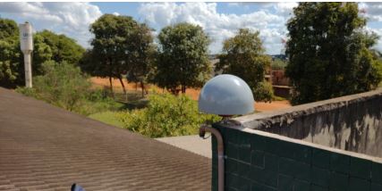
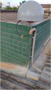
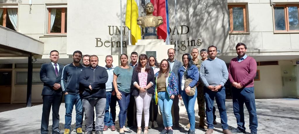
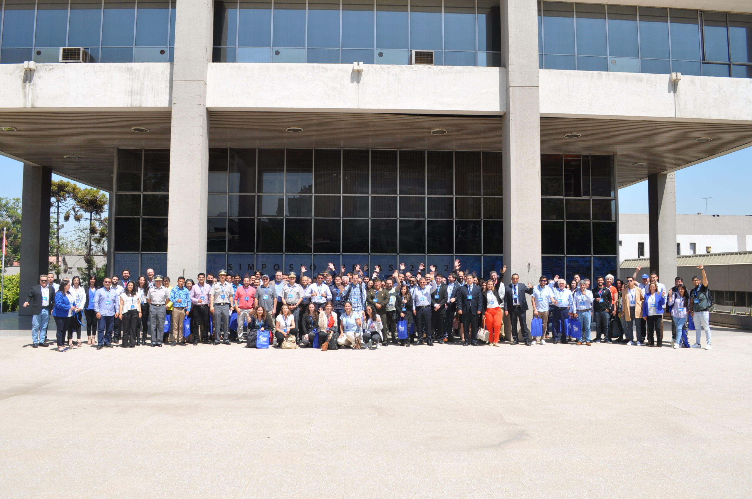
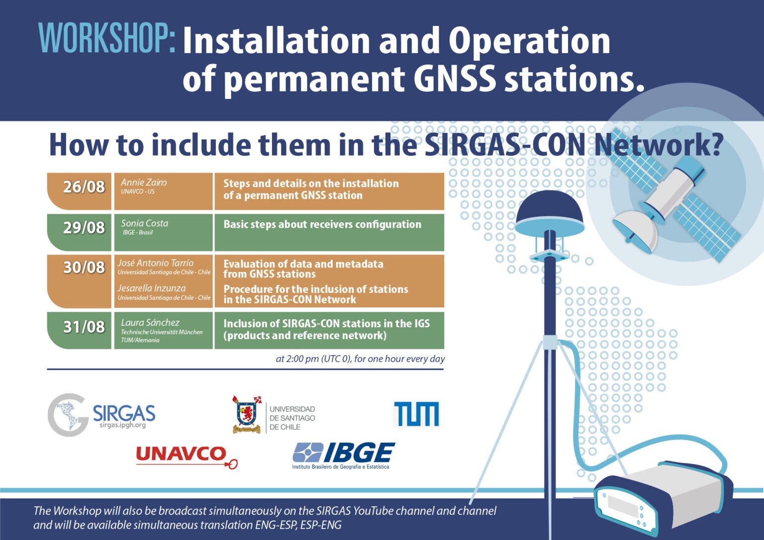
From November 7th to 9th, was held the SIRGAS 2022 Symposium in Santiago, Chile, under the organization of the Military Geographic Institute (IGM) of Chile. The central purpose of the SIRGAS 2022 Symposium was to call the geodetic community of the Americas and Caribe dedicated to the study of problems related to Earth observation and global changes. Including the establishment of reference systems, the Earth’s gravity field and rotation monitoring, as well, the deformation of the Earth’s crust, including oceans and ice, and geodetic positioning for interdisciplinary use. The combination of several technologies, among which GNSS stands out, collaborate in the modeling improvement of seismological and atmospheric processes, contributing to the mitigation of natural disasters caused by seismic activity, to the weather forecast and to the sea level rise monitoring. It was the first time that the Symposium was held in a hybrid way (face-to-face and online) and the second time with simultaneous translation, important changes to promote the participation of more countries on the continent.

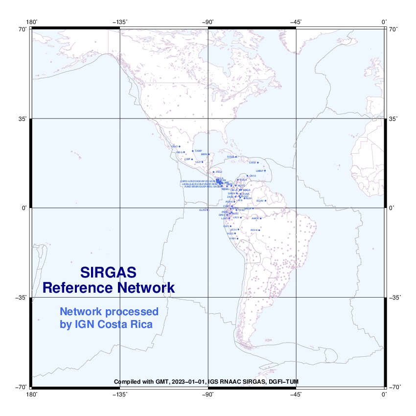
There were 59 presentations from the following countries: Germany, Argentina, Canada, the United States, Costa Rica, Colombia, Brazil, Ecuador, Bolivia, Chile and Uruguay. The average number of attendees during the 3 days was 90 participants in person and 130 remotely. SIRGAS activities were carried out since 1993 in the American continent and are aligned to support the Nations of the Americas in response to the United Nations General Assembly Resolution entitled “A Global Geodetic Reference Frame for Sustainable Development” (A/RES/69/266), through the modernization and unification of the Geodetic Reference System of the Americas. The unification and integration are important for the development of infrastructure, such as: roads, sanitation, energy, and land reform, as well as for climate change monitoring and preventing natural disasters. To align SIRGAS activities to the GGRF (Global Geodetic Reference Frame) Roadmap, a resolution dealing with the opening of GNSS data repositories was approved last year by the Directing Council. This year, the proposed resolution submitted for approval deals with the advances to the implementation of Resolution 69/266. One of the objectives is to support and encourage the development of geodetic capabilities within the Americas and the Caribbean for the establishment and maintenance of a high-precision geocentric network, as an ITRF, IHRF, and ITGRF densification in the continent and the link of national geodetic infrastructures in the region, as well as, the connection of the national reference frames towards the ITRF, IHRF and ITGRF.

The next symposium will be in 2024 in Bogotá, Colombia, coordinated by the Agustin Codazzi Geographic Institute (IGAC).

Vertical Reference System Workshop

From November 2th to 4th was held the Vertical Reference System Workshop exploring topics related to the unification of the vertical datum for the SIRGAS country members, according to the guidelines and actions directed towards the materialization of the IHRS (International Height Reference System).

The workshop main objective was to contribute to the training process of researchers, professionals, and technicians of the Americas who participate in the investigation, definition, and updating of national vertical reference frames and systems based on the processing of gravimetric and classical leveling information. The attendees were trained in the use of program packages developed by the International Association of Geodesy (IAG) and SIRGAS, which are freely distributed for those organizations dedicated for the materialization of national geodetic reference frames, or that contribute to the activities and research carried out by SIRGAS.

This workshop was coordinated jointly with the Military Geographic Institute of Chile at the facilities of the Bernardo O’Higgins University and was given in Spanish by Dr. Gabriel do Nascimento Guimarães (Federal University of Uberlândia) and Hernán Javier Guagni from the Institute National Geographic of Argentina. The workshop participation accomplished Fourteen professionals from 7 countries of the American continent.

Workshop “Installation and operation of permanent GNSS stations. How to include them in SIRGAS-CON?”

Between August 26 and 31, 2022, the virtual workshopInstallation and operation of permanent GNSS stations will be held. How to include them in SIRGAS-CON?” This workshop is aimed at the geodetic community of SIRGAS and the Caribbean, mainly at current and future GNSS data centers and the main objective is to train participants on the installation and operation of permanent GNSS stations, carrying out a series of practical activities. about the metadata, formats and contribution of SIRGAS to the products and IGS reference framework.

This workshop will be held through the Zoom platform, on August 26, 29, 30 and 31, 2022, at 2:00 p.m. (UTC 0), lasting one hour every day.

The Workshop will also be broadcast simultaneously on the SIRGAS YouTube channel, and will have simultaneous translation ENG-ESP, ESP-ENG

Registration: https://reuna.zoom.us/meeting/register/tZwude6hrTgtHtRznzK5F7g_z8CJkp0gO5YD

Programming:

Day
Exhibitor
Subject
26/08
Annie Zaino

UNAVCO – US

Steps and details on the installation of a permanent GNSS station
29/08
Sonia Costa

IBGE – Brasil

Basic steps about receivers configuration
30/08
José Antonio Tarrío

Universidad Santiago de Chile – Chile

Jesarella Inzunza

Universidad Santiago de Chile – Chile

Evaluation of data and metadata from GNSS stations

Procedure for the inclusion of stations in the SIRGAS-CON Network

31/08
Laura Sanchez

Technische Universität München – TUM/Alemania

Inclusion of SIRGAS-CON stations in the IGS (products and reference network)